|
|
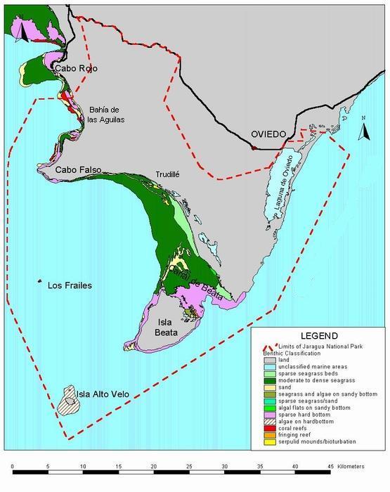
Map of Underwater Habitats of Jaragua National Park
|
|
This is an underwater habitat map of Jaragua National Park. The park's boundary is shown by a red dotted line. The black line is the highway or another paved road. Move your mouse over the map until the pointer changes into a hand. Then click to view some of the underwater landscapes of Jaragua National Park. |
|
|
Last Updated: 17 Nov 2005 Questions or coments about this page? contact: Yolanda León
|